Since long, i wanted to have a trip through Norway. However, last year the weather forecasts promised rain, rain, rain all the time, and i did not find the time to make the long trip. This year, i had to travel to Norway because i had to attend to a conference in Trondheim. Thus, i asked my boss if he would object against if i have an one-way flight and make the way back to Germany on my bike - he was fine with the idea :-)
I needed some time to figure out on which way i could return from Norway to Germany. There is a ferry from Oslo to Kiel. However, this ferry is very expensive; about 400 EUR. In contrast, the ferry from Trelleborg to Sassnitz in Germany costs only 20 EUR. Because i do not know Sweden, i decide to spend 5 extra days to cross Sweden along the west coast. I have high expectations regarding Norway, but i do not expect something particular from Sweden at all -- i just intend to cross it on the shortest path.
As usual, i do not find the time (and the mood) to do some sophistic planning. I get a few GPS tracks from rad-forum.de and gps-tour.info. In addition, i fetch the GPS coordinates of Alesund, Rallarvegen, Geiranger-Fjord, Eagle-Road, Trollstigen and the road across the Sognefjell from the Internet, because these seem to be the most important sightseeing spots in the middle of Norway. Furthermore, i manage to find the GPS-track of the North Sea Cycle Route in Norway and Sweden somewhere in the net. If i join all these points, i have a nice route from Trondheim to Geiranger (400km), from Geiranger over the Trollstigen to Lom (500km), along Rallarvegen and the Numesdal bicycle route to Drammen (500km), and from Drammen to Oslo (100km). From there, the way along the coast to Trelleborg adds about 800km. All in all, i have 2300km - no too much for 19 days vacation time, and i have still a few hundred spare kilometers and the option to make shortcuts.
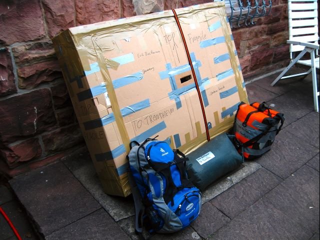
It is problematic to bring a bicycle from Karlsruhe to Trondheim First, i have to carry not only the bike, but also a laptop computer and fine clothes for the conference. Second, there is no direct flight from Germany to Trondheim, and i do not trust the airlines to handle my bike with care when reloading it from one airplane to another one. My solution is to take the night train from Karlsruhe to Amsterdam, where KLM offers a direct flight to Trondheim. Furthermore, i unscrew as many parts of my bike as possible, and i pack each part very carefully.
Since i expect cold weather, i have to carry appropriate clothes and
a warm sleeping back that lets me stand temperatures below
0°C. This means, i have quite much baggage, which is
distributed over a round duffel bag and two Ortlieb Frontroller
bags. In addition, a backpack holds my camera, laptop and things
i'd like to have at hand. I have even room for some luxury: A
good knife, a second pair of shoes, an alcohol stove, a cooking
pot, a shaver and a second 0.5cm foam mattress in addition to my usual
2.5cm air mattress. My bicycle dealer
equips me with some spare parts: brake shoes, wires for
gearshifts and brakes, spokes and others. At the very last
minute, i decide to be an optimist and buy a swimming suit.
I always carry a GPS device with me. Thus, at the end of the tour i
have a seamless record of my route. This looks as follows in
Google Earth: 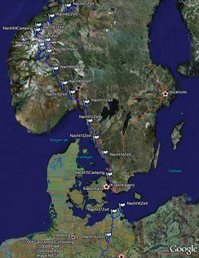
Here you can see the track in Google Maps.
The night train leaves Karlsruhe at midnight. The bicycle compartment is booked out; however my bike is packed as oversize baggage and can be crammed into a corner. Due to that much luggage, the trip to the airport requires strength, but eventually it is quite unproblematic. However, i don't think that i like to carry around that much weight again. In particular, it is stressful to switch trains at stations without an elevator.
At the airport, the security people show that they can be stupid: I want to carry my baggage on the shortest path over a moving staircase from one level to another. Therefore, i have to go twice. Just as i dropped my bags besides the upper end at the stairs and want to fetch my bike, the security comes: "Is this your luggage?! You cannot leave it unattended!". There was no argument: it does not count that i can see my bike just at the lower end of the stairs, and that i will need only seconds to move it to the upper level. I have to open my bags (no bomb inside), and i have to put them on a trolley and take a detour to an elevator to fetch my bike. It does not matter that now i lose sight to my bike in the process.
I pay 40 EUR for my bicycle and hand it over at the counter for oversize luggage. At this moment, i learn for the first time how much all the stuff weights that i plan to drive around: 20kg are in the bags for the bicycle carrier. In addition, i have a backpack, and if my bottles are full, i have 3kg water and drinks with me.
The flight and the arrival in Trondheim happen without incidences. The bicycle box is quite damaged, but the very well wrapped bike is absolutely undamaged. At the place in front of the airport in Trondheim i screw the parts of my bike together. Here i get my first shock: i forgot to bring a 4mm inbus wrench with me, which is required to fix the screws of the carrier. I can do some improvisation with another wrench, but i will have to buy a proper tool in Trondheim.
Now i cycle the 34km from the airport to the hotel in Trondheim. It is warm and sunny. Some guy has told me that Norway would be cold. My clothes are chosen respectively. After 5 minutes, i seek some shelter and change to short trousers and shirts.
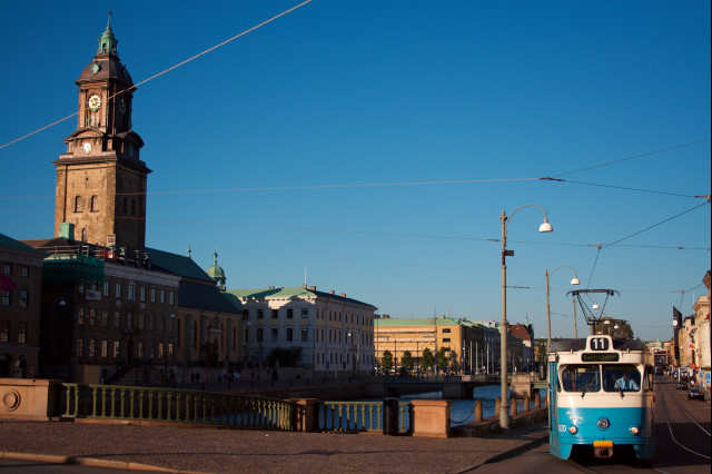
Trondheim is a small, nice city. The old town is placed at a
loop of the River Nidelv. Old, wooden storage buildings on stakes
line the shores of the river.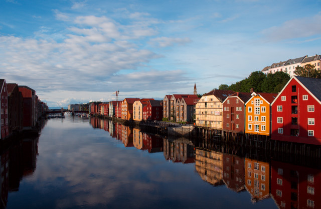 A big
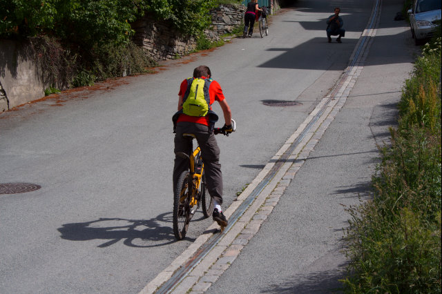
attraction is the bicycle elevator "Trampe", which moves bicycles
to the top of a steep hill. A cyclist has to place his foot on a
little platform, pushe a button, and the platform moves upwards on a rail.
Half of the people (mostly tourists) lose balance in between.
A big
attraction is the bicycle elevator "Trampe", which moves bicycles
to the top of a steep hill. A cyclist has to place his foot on a
little platform, pushe a button, and the platform moves upwards on a rail.
Half of the people (mostly tourists) lose balance in between.
While midsummer, the sun goes behind horizon between 11pm and 2am, but just very close - the sky just stays bright. I assume it will be difficult to fall asleep in a tent.
Friday is the last day of the conference. At the day before, i sent my laptop, the conference proceedings and other stuff per snail mail to Germany. Since no one seemed to believe that i am really driving home on a bicycle, i make a show of my departure: at 4pm, right after the organizers close the conference, i change clothes at the men's room, load my things on the bike and drive off :-)
I take the Riksveg 707 beneath the nature park in the west from
Trondheim. After that, i drive in the direction of Melhus and follow the RV
708. I am a little bit disappointed: besides the fjord of
Trondheim, the landscape resembles the Black Forest, which i have
at my doorsteps at home. Both Black Forest and this place feature round hills
with pine forests, and farmland or meadows in between. This seems
to be a problem if one starts with very high expectations. Anyway, i
am happy to be on my bike after one week sitting in conference
rooms, and the weather is good. 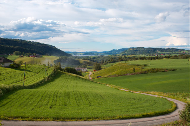
Because i started late in the afternoon, i do not drive very
far today. In order to get clean, i jump in a mountain lake (the
Anoya) at 7pm, and i congratulate myself to have brought a
swimming suit. The water is very clean, but rather cold. But due
to sun and wind i dry very quickly. 
10km further down the road i find a niche for my tent at a clearing in the forest besides the road.
76km, 4:16h, 800m difference in altitude, weather sunny to cloudy
After i had a breakfast and pack my tent, the sky gets
black and it starts thundering: Continuous rain until the night
comes. First i follow the 65 to Surnadalsora. There i meet a
bicycle tourist from Poland, who got shelter from the rain in a
waiting room at a bus stop. His bike is sick: the front hub makes
scratching noises. I have a spare screw to fix his loose mud
flap, but obviously i do not carry spare hubs around. We try to
repair the hub, but we are not successful. I wish him good luck,
say goodbye and drive along the 670 to Melhus. 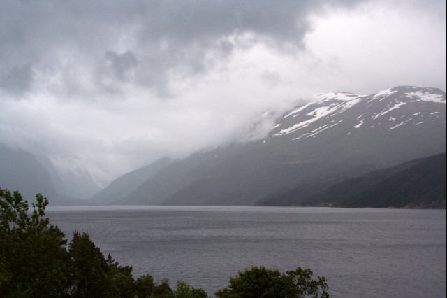
I really appreciate that many country roads feature clean toilets. It is not that funny to sh***t in the woods while the rain keeps falling. In most cases, the resting areas are less than 15km away from each other, and the restrooms are always very clean.
Behind Melhus i take the ferry over the fjord and follow the 70 to Sunndalsora. Behind the village, the road goes through a tunnel. However, it is getting late: i take the old country road which was built before the tunnel, and which is used very infrequently. There, i place my tent besides the road and fall asleep. All people use the tunnel - not a single car drove the road all the night. Unfortunately, while i try to wash myself in a creek, i run into a swarm of gnats. Gnats are tiny midges which appear in huge swarms, and which bite immediately after landing on my skin. Later, i count more than 30 stitches just on my right lower leg; the rest of my arms and legs look similar. The stitches itch terrible for a week. I have learned something today: never set up the tent near a creek in suspicious terrain, and never walk to and fro outside if not absolutely necessary. Instead, do the things required as quick as possible, and close the tent. As a side effect, the gnats decide the question of cooking or not: I cannot light my stove in a tiny one-person tent. Furthermore, i do not intend to carry one extra kilogram for the fuel. In consequence, for the remainder of my trip i carry an useless stove and a cooking pot, and i eat in restaurants or stick to cold meal. However, Norwegian cheese, sausage, fish and bread are quite delicious, thus i do not miss anything.
142km, 8:00h, 1500m difference in altitude, continuous rain for the whole day
The day starts cloudy, but dry and nice. I follow the 62 to
Eidsvag, and take a tiny country road along the Langfjorden to
Solsnes. 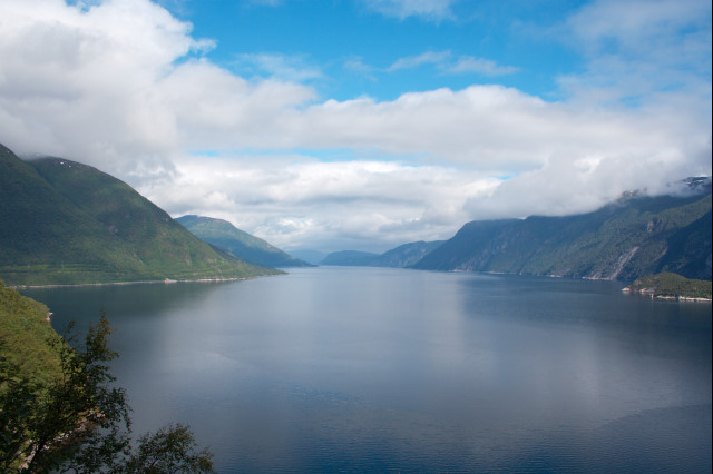
Rather quick i find out why the Langfjorden is called
Langfjorden (In German, "Lang" means "long"): it is long and boring. The road goes straight
ahead for 35km, with water on the left and tree-covered hills on
the right. For this reason, i am glad when i eventually reach the
ferry in Solsnes. 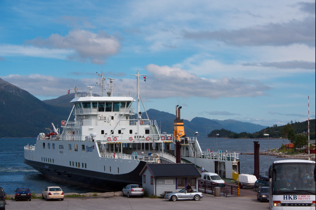
Now i follow the 64 for some distance. In order to arrive in Andalsnes i have to cycle 30km around the Isfjorden. In Andalsnes, my GPS displays 100km and 900m difference in altitude for this day - i am not tired yet. Thus, i eat the largest burger menu in the next best fast-food restaurant, and head for Trollstigen at 4pm.
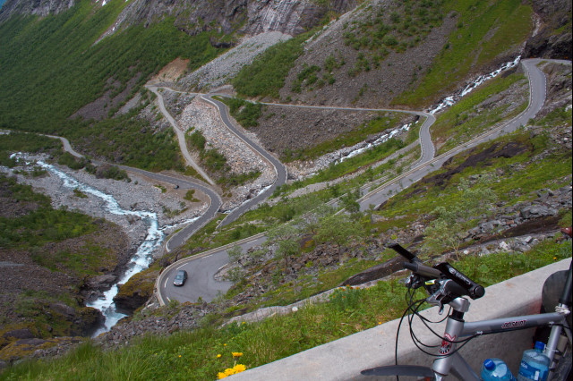
The Trollstigen is my first sightseeing spot in Norway. It is
one of most known touristic roads in Norway. Specifically,
Trollstigen is a mountain pass with an altitude of 880m. The ramp
to the pass crosses one large and multiple small waterfalls.
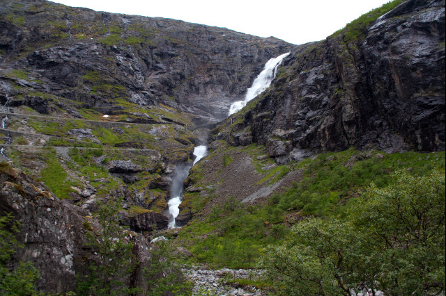
Actually, Trollstigen is very spectacular. I get wet on the
bridge over the large waterfall, and i have a great scenic view
from the curves of the road. Fortunately, due to the late time of
the day, only a few motorbikes, caravans and buses populate the road.
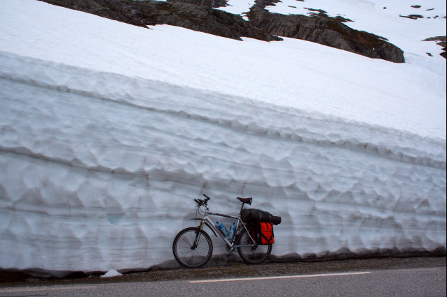
At the pass it is rather cold. It is supposed to be summer, but there are
many huge snow banks along the road, which do not thaw quickly.
On the parking lot at the pass, a friendly guy from the Netherlands pours
me a cup of coffee, and we talk a little. I get a nice hint
for a place for the night. However, i want to be below an
altitude of 200m before will i think of building my tent - it is far
to cold up here. 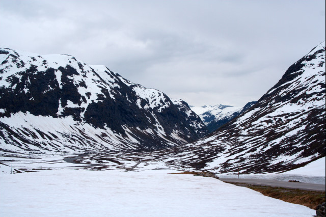
I spot a very nice place for my tent on a peninsula in a melt-water river. The river is very fast and has rapid cataracts, but i find a good place to have a bath and to wash my clothes in a washed-out loop of the river.
153km, 8:15h, 2000m difference in altitude, weather cloudy and cold
Today, i face a strong and continuous rain. For this reason, i
manage to pack my tent and start riding not before 11am, and i
start with a rather bad mood. 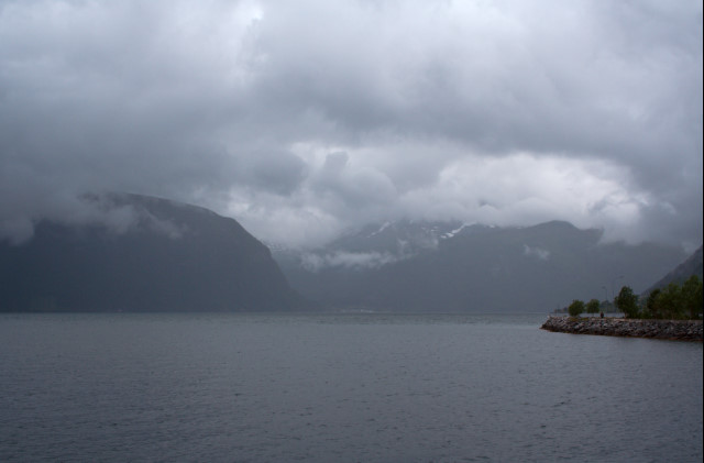
My plan for today includes the Eagle Road. It is part of the
63 and connects the cities Geiranger and Eidsdalen. There are
many beautiful scenic views on Geiranger and the fjord from the
steep curves of the southern ramp. At least, i suppose the view
would be beautiful if it does not rain - but today it rains
heavily. 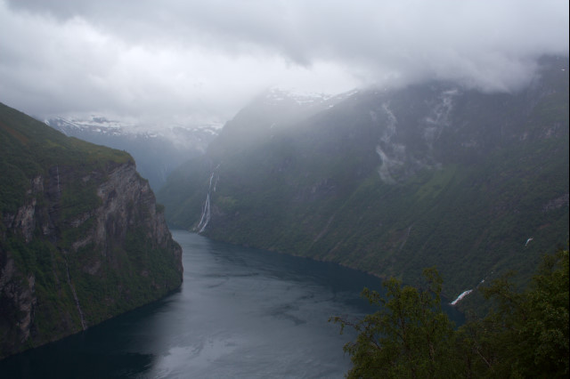
The city Geiranger is not that beautiful: it is crammed of hotels and souvenir shops. The rain adds its share to my impression. Thus, i tend to hit the road. But on the way out of the city, a bicycle driver from Switzerland stops me and asks: "Do you know that the road goes up to an altitude of 1000m, and are you really sure that you want do this in the rain?" - Since i can answer both questions with a clear "No", i follow the Swiss to the camping site.
A camping site offers a shower and the means to wash the clothes. However, i always sleep rather bad there: it is too noisy, you hear anything through the fabric of the tent, and with some pity other guests want to have a party until the morning. The place in Geiranger is ok - except the continuous, ear-penetrating screams of the seagulls and a truck driver starting his truck before 6am prevented from a good sleep.
36km, 2:30h, 650m difference in altitude, continuous rain for the whole day
The day starts with a very light rain. After my new Swiss friend and me packed our stuff and drove a few hundred meters
upwards, we see Geiranger and the fjord for the first time
without rain. The biggest ship in the fjord is a cruise ship from
Germany. The curves on the right side of the picture mark the
beginning of the Eagle Road. 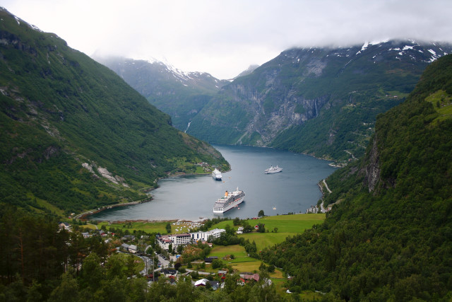
We follow the 63 which climbs up to a pass to an altitude of
1000m. On top, the light rain switches to a light snow storm.
Below, we see a couple of bicycle drivers following us. They come
from the cruise ship. According to the style they cycle, we
assume they will be a case for the board masseuse afterwards, and
they aren't any faster than we are, despite our heavy-weight
baggage. We chat with the only tough guy of the pack -- he comes
from Brasilia, and he is the tour guide of the ship. 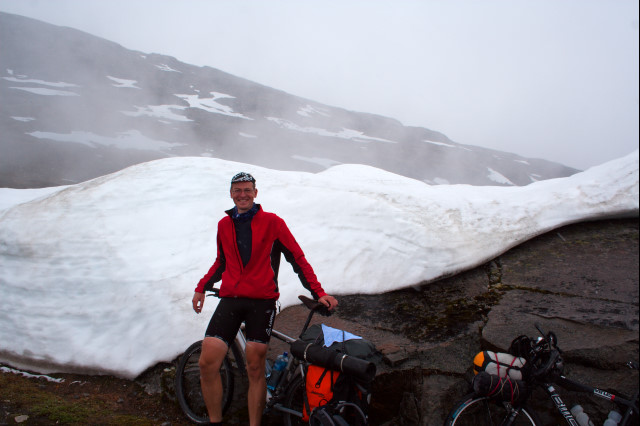
The weather is quite hazy. Thus, we decide that it does not
pay off to climb from an altitude of 1000m to 1500m on top of the
scenic spot "Flydalsjuvet". Instead, we have a coffee at the
restaurant near the pass, and we follow the 63. The road follows
the edge of a large lake, which is so buried under ice and snow
that it can be seen only on the map of the GPS. 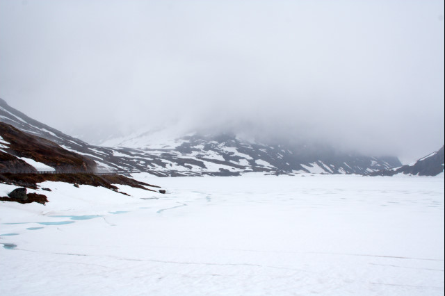
Since we find the road boring, we take a rubble road
parallel to the 63. Here we have heavy rain for a couple of
hours. 
In Grotli we have to say goodbye - i want to drive to Lom, my
Swiss pal has different plans. After Grotli, i follow
the 15. Since more cars drive the road than i like to see, i take tiny
side roads which connect small villages in the valley. The
landscape is beautiful: the river pushes through steep rock
formations and cataracts. 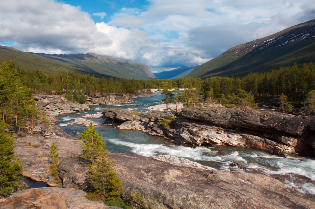
In Lom i see my very first stave church. Such churches are
artfully encrusted with paintings and wood carvings, and they are
very typical for Scandinavia. 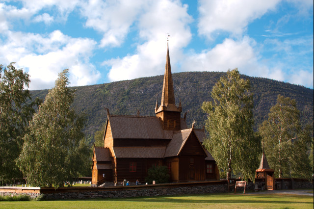
From Lom i start to my third touristic highlight: The road
across the Sognefjell. But it is too far to make it today. For
this reason, i leave the RV55 near Slaligrende and follow a side
valley. There, i set up my tent at an altitude of 950m on the
shore of a lake, above the tree limit. It is too cold for gnats
and midges, and i find a beautiful niche that prevents me from
the wind: really perfect. I try to have a bath in the lake, but
quickly my hands and feed get numb from the cold, thus i have to
keep my bath really short. 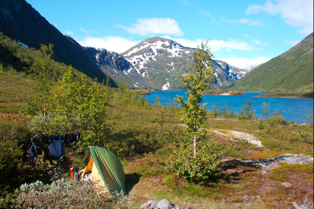
140km, 8:30h, 1500m difference in altitude, it rains from noon to the evening.
The day starts sunny. In order to reach the Sognefjell, i have
to climb from 950m to 1440m only. At the fjell i have a terrific
view over the mountains of the Galdhopiggen. Everything is
covered with clean white snow, and the sun and the clouds paint
pictures and patterns on the snowy slopes of the mountains. Small
stone pyramids mark ancient paths over the fjell. 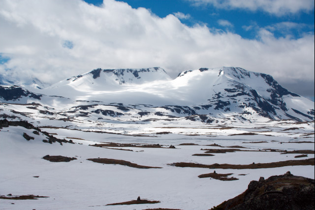
Huge snowbanks tower to the right and left besides the road,
but fortunately the road is cleaned. At this height, ice and snow
do not thaw - there are no creeks of molten ice.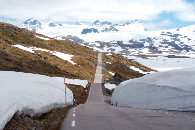
The descent from the Sognefjell to Skjolden down in the valley
is noteworthy: I start in the cold at 1440m altitude, and go down
to 0m at the fjord, where it is warm enough to drive in short
clothes and spare the undershirt.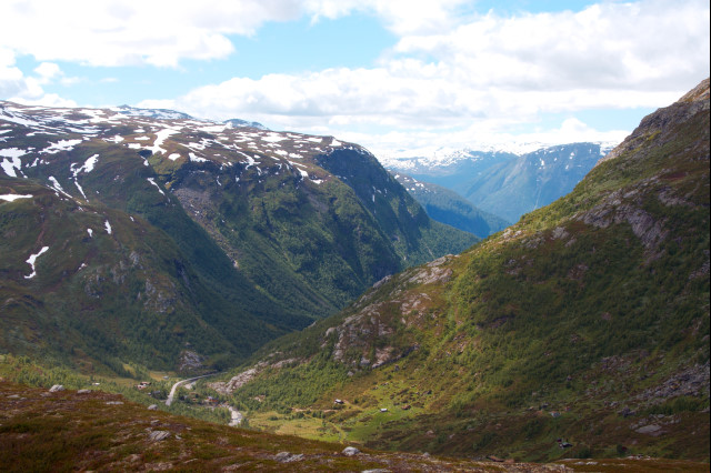
In Skjolden i take a tiny, unpopulated road to Urmes. The road
features three long, dark tunnels. The longest (900m) has neither
cat eyes nor markings along the side of the road: everything
looks gray in gray. It is next to impossible to tell if the gray
thing in the spot of the lamp is the floor, a wall or the
ceiling. I drive very slow and carefully - i am thrilled since i
cannot say if i am near the right or left side of the road, for
the case a car wants to pass. It is funny to note that the local
authorities have installed boxes with pocket lamps at both ends
of each tunnel: Bicyclists are supposed to use these lamps, and
put them in the box at the other end of the tunnel after having
passed it. On the way to Urmes i have a little stop in order to
visit the Feigumfossen, with 218m the second-highest waterfall of
Norway. 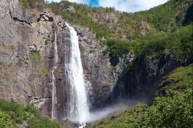
Once i arrive in Urmes, everything goes wrong: I miss the last ferry of the day for a couple of minutes. Because i am not tired yet, i want to continue driving. First i try the hiking path over the mountains through Krokendal. But after pushing the bike upwards on a steep hill for a half hour, the way becomes so rocky that i would had to carry my bike - is is impossible to come through. I have to turn around and drive around the fjord on the already-known road. I do not find a good place for the night either: my camp is near a waterfall, in which i have a shower, but which is too noisy to find sleep.
117km, 7:30h, 2000m difference in altitude, 1440m max. height, weather sunny to cloudy.
Because i cannot sleep, i get up at 4am in the morning and
continue my tour. The sun is just above the rim of the mountains
along the Lusterfjord.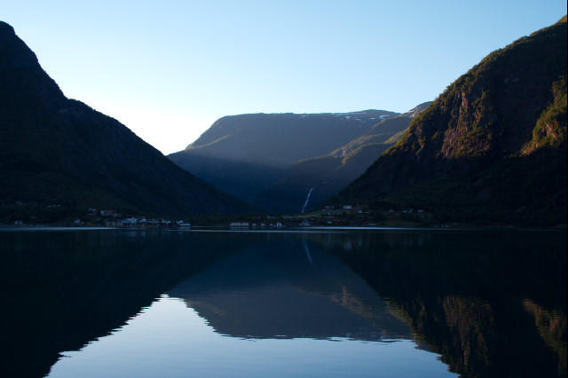
I follow the RV55 till Sognedal. After that, i take the 5 over
Kaupanger to the ferry. In the early hours is no wind, and the
huge fjord is smooth like a mirror. 
On the way, i pass my longest tunnel so far. It is 3km long. The ferry is huge, and two of them drive permanently between both shores of the fjord. The 6km-tunnel to Erdal is forbidden for bicyclists. Although i know that the guy from Poland i met the day before made it through, i have heard from some other bicyclists that the Rallarvegen cannot be passed due to heavy snow banks. I am not in the mood to load my bike into a train in order to overcome the snow at the Rallarvegen. Thus, it makes no sense to take the tunnel. Instead, i take the RV53 (many tunnels with lengths between 1 and 2.5km) to Ovre Ardal. To my surprise, i like that road: Here, for the first time Norway looks really authentic. There are no camp-mobiles, no tourists, the road looks a little bit dusty and dirty, nothing is polished - just the normal everyday life. I enjoy this very much after the last days where every second car seemed to be a caravan.
After passing Ovre Ardal, the road becomes steep, and it
starts to rain. Anyway, i make my way upwards until i reach the
Tyin lake at an altitude of 1100m. 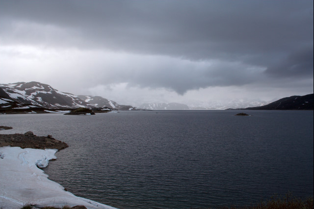
There i find that i am too wet and too sticky to camp in a tent: i take a hotel room in the Filefjellstuene. The room is expensive, but it is worth every coin: It has a living room, two bed rooms, bath, kitchen, a little lobby, a balcony, under-floor heating systems and heated racks for clothes and shoes. I wash my clothes and appreciate a wonderful bed.
160km, 10:00h, 2400m difference in altitude, 1130m max. height, weather sunny to cloudy, rain in the afternoon.
Today, i enjoy a great breakfast. The waitress brings a splendid english breakfast: breads, crispy bacon, eggs, toast, coffee, orange juice, waffles, marmalade, fish, fruits - i eat everything, except the table decoration.
From now on i do not have a fixed plan. I have visited all
places i was eager to see, and all that remains is to drive in the
rough direction of Germany. First i follow the unpopulated road
E16 (part of the Kongsvegen), after that i drive through the
Hemsdalen on the 52. On the way i have many scenic views over
lakes and flat highland areas (fjells). 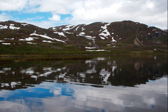
At Gol i take the road through the Hallingdal, and follow the 7 to Nesbyen. I do not like the 7 too much; the traffic is very dense. In Nesbyen, i make a big error: with Cola in my belly and Hammerfall playing in my MP3 player, i drive much too fast on the middle chainwheel over the 500m high hill to the Tunhovdfjorden. For the next three days, i will have to drive very slow and carefully, because my knees hurt uncomfortably.
On top of the hills, it rains very strong. I do not have the time to look for a nice place for the night, thus i place my tent at the next best clearing in the wood, among many gnats and midges. However, i the last days i learned to avoid these creatures, i get only a few stabs.
160km, 8:45h, 1600m difference in altitude, 1146m max. height, cloudy weather, rain from afternoon to night time.
Today, i drive to Rodberg first, and i follow the Numedalen
after that. 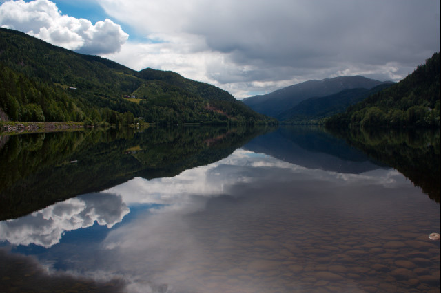
In Nore i see my first stave church from the inside. It has
many nice paintings on wood, and everything looks and smells
really ancient. To my regret it is not allowed to take photos from
the inside, even without using a flash. 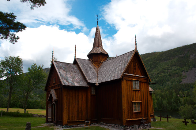
After that, i drive on roads that are wet from the rain in
front of me - but over me is a gap in the clouds, and i cycle in
the sunshine. It seems as if the rain does not aim that good in the
south of Norway. I catch a few spots of heavy rain, but these are
quite short and do not have an impact on my good mood. Many old
wooden farm buildings and storage houses are on the side of the
road. 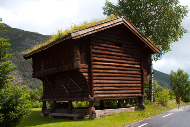
In order to unburden my knees, i have a long break at the stave church in Rollag. There i have a little chat with a young Norwegian who is the gatekeeper of the church: "You came from Trondheim on this???" - he is astonished. I share my chocolates, and i obtain some pictures from the gorgeous inside of the church in return. I like the people in Norway: All i met were really friendly and open-minded; i enjoy to have a chat with them.
Because the midgets are much less in numbers, as compared to
the middle of Norway, i risk to set up my tent at the edge of the
river. In the evening, the farmer comes by on his tractor, and we
talk a little. I am quite impressed: even the farmers
speak a fluent english. The farmer is not bothered that i placed
my tent on his meadow. I finish the day swimming in the river and
enjoying the view from my tent. 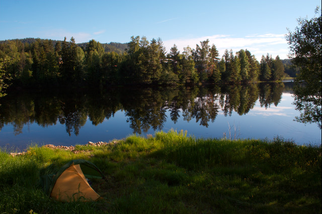
106km, 6:00h, 800m difference in altitude, 818m max. height, cloudy, sometimes heavy rain
Today i find the rain clouds far away, in the north from my
position. The landscape of the Numedal is very similar to the
Black Forest: no too high, not too steep, woods on the hills,
farmland on any horizontal places. 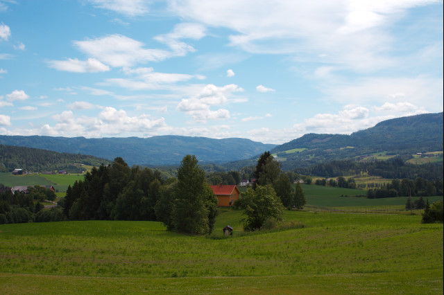
In Kongsberg i make up my mind: I will avoid Oslo, since all
people i met in the last days told me that Oslo is just a big
city without something i had to see at any price. Instead, i will
head in the southern direction, in order to take the ferry from
Horton to Moss over the Skagerrak. I like sparsely-populated
areas much more than heavy traffic on big roads. 
I set up my tent in a clearing, after i swam in a nearby lake.
90km, 5:45h, 900m difference in altitude, 200m max. height, sunny weather, steady adverse winds
Today i start with a short ride of 30km to the ferry from
Horton to Moss. The ferry is big, and three of these cross the
Skagerrak permanently. By mistake i dodge the fare for the ferry:
Since i am prohibited to drive on the car lane, and i do not fit
on the pedestrian's lane, i search my way through the harbor and
miss every signpost to the ticket office. On board, after leaving Horton, a passenger tells me
that i had to buy the ticket in the harbor. But since there were
no checks at the ferry, this is no problem. 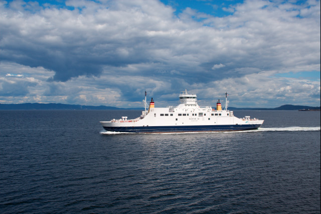 Once arrived in
Moss, i try to follow the North Sea Cycle Path. However, this
bicycle path is terrible here: It makes many detours, i am led
across sandy dirt tracks with many roots and rocks, and sometimes
the way is too bad to drive so that i have to push my bike. A signpost near
Halmstad tells me that the cycle path reaches
Frederikstad in 40km. However, my GPS shows me that Frederikstad
is just 20km away if i take the country road. Thus, i decide that
i have enough with the bicycle path, and i take the better road. Shortly
before Sarpsborg i see a nice place to swim and have a
break.
Once arrived in
Moss, i try to follow the North Sea Cycle Path. However, this
bicycle path is terrible here: It makes many detours, i am led
across sandy dirt tracks with many roots and rocks, and sometimes
the way is too bad to drive so that i have to push my bike. A signpost near
Halmstad tells me that the cycle path reaches
Frederikstad in 40km. However, my GPS shows me that Frederikstad
is just 20km away if i take the country road. Thus, i decide that
i have enough with the bicycle path, and i take the better road. Shortly
before Sarpsborg i see a nice place to swim and have a
break.
Near Svinesund i cross the border to Sweden by mistake. Actually, i had many Norwegian crowns left, and i wanted to spend them before i go to Sweden. However, evidently i cycle over a bridge and find myself surrounded with sex shops and shops that sell cheap alcohol and tobacco: I assume that i crossed the border. 15km down the road i set up my tent in a clearing in the forest.
123km, 8:00h, 1300m difference in altitude, 164m max. height, sunny weather, steady head wind
I Sweden the North Sea Cycle Route follows much better roads than in Norway, thus i decide to give it a shot. Anyway, i always take the shortest road if the cycle path is about to make a huge detour over a peninsula or tongue of land.
Today is the day of rock carvings: i pass approximately 8-10
signs "Hällristning" in the Bohuslän (a region in West
Sweden between Halden and Uddevalla). The largest sites are near
Tanum. Here, the carvings are filled with red color for better
visibility. The creators must have had quite a penis fixation:
The carvings make it absolutely clear if they mean a male person or
animal. 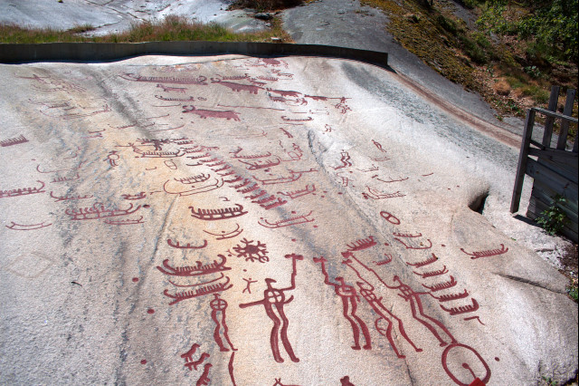
The explanations to the carvings are interesting. While the
eldest stone carvings display many small figures, later carvings
are dominated by few huge images of goddesses, which even overlap
with small figures from older carvings. The youngest carvings
even include satiric cartoons, e.g., a man with a huge nose
sitting on a bent horse with a hollow back. 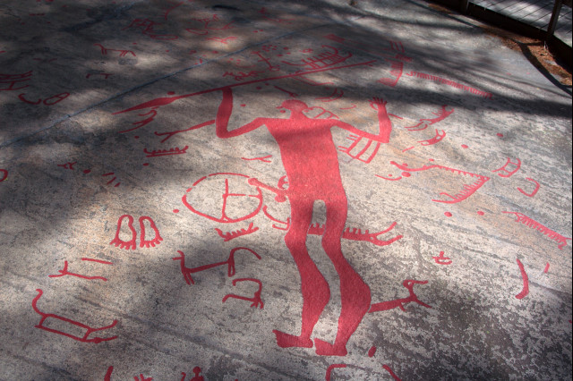
Now my tour goes along a skerry coast. One can see how the
glaciers have shaped the coast: any rock is round and aligned
from north east to south west. Since my direction of travel is
south east, i have to cross these structures, thus it goes up and
down for the whole day. The head wind is steady, but not very
strong. 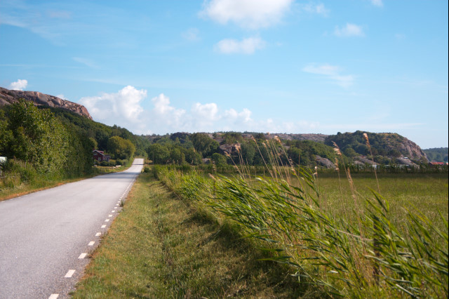
Although the road does not climb to an altitude of more than
95m, i collect a total of 1250m difference in altitude over the
day, just like an ordinary pass in the Alps. But the scenic
outlooks over the coast are worth any efforts.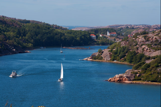
In the evening i set up my tent on a tiny isle, about 8km
air-distance southern from Lysekill. Here i learn another important
lesson: do not make close friendship with the cat from the
neighbors. After you have played with her, she wants to follow
you into your tent by all means :-) 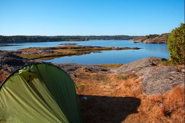
133km, 7:30h, 1250m difference in altitude, 95m max. height, sunny weather, steady head wind.
The day starts with another ferry that takes me from the isle.
These ferries do not have an propeller, but pull themselves on a
rope from coast to coast. Surprisingly, it seems that the ferries are for
free - i do not have to pay for the passage. 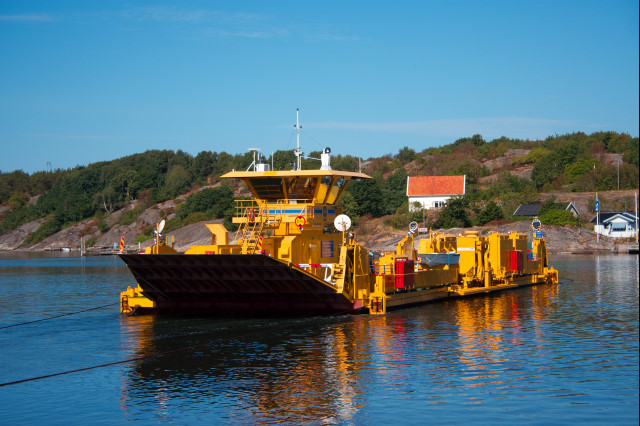
The day passes without much incidents. At first i enjoy nice, calm side roads along the shore. After crossing Varekill, i am not so happy with a cycle path besides to a country road with heavy traffic. Despite many jellyfish, i swim in the Skagerrak near Stenungsund. This was a big mistake: The water is so salty that i am just as sticky from salt as i was sticky from sweat before, and i catch a sore spot on my back after one or two hours bicycling. This will result in three 'funny' days... However, i find a nice lake in the inland behind Jörlanda, where i can wash off the salt.
Behind Kungälv i recognize that i get near to
Göteborg: the density of the traffic increases steadily.
After three weeks without a city that i could not cross within 15
minutes on my bicycle, Göteborg is a shock: a true metropolis.
Sadly, i arrive in Göteborg at 7pm. Thus, i have no time for a comprehensive sightseeing tour, but have to leave the densely populated city soon in order to find a place for my tent before sundown. This is the case in a beautiful forest behind a beach near Nordanskog, about 30km south from Göteborg.
143km, 8:15h, 1150m difference in altitude, 119m max. height, sunny weather, steady headwind.
The landscape becomes considerably more flat and even. I have
left behind the skerry coast, and here starts the flat
countryside of Sweden's west coast. 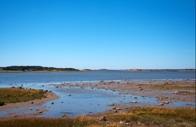
The highlight of the day is the nature reservation Fjäras
Bräcka near to the City Kungsbacka: is has a deep, cold see
to swim in, an end moraine area that is worth a look, and a large
cemetery from the Iron Age. 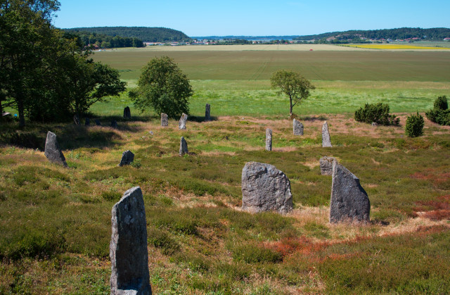
I take the road along the coast over Varberg and Falkenberg.
Varberg has a large castle, and a beautiful wooden bath house on the
coast. 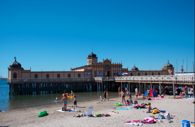
I arrive in Falkenberg quite late, and the most guests are gone from the beach. Thus, i enjoy swimming in the sea. The beach offers freshwater showers and toilets, and everything is clean and for free. I place my tent at the entrance of the bird reservation Grinshomen. It is a nice and quiet place. Here i get confused by a passing local: He takes a look on my luggage and asks: "You are not alone, right? Where is the second guy?" Before that, i thought i had quite few baggage...
118km, 7:00h, 650m difference in altitude, 61m max. height, sunny weather, steady head wind.
Today i pass many prehistoric burial mounds. These are easy to
see; the most of them are located in the middle of fields.
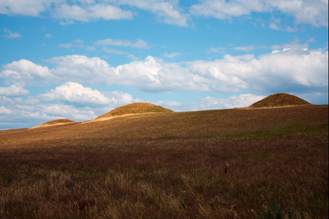
Furthermore, i see many windmills and some prehistoric stone
pits where the people mined for flintstones. The whole region is
flat and populated. I drive through Halmstad, Bastad and
Angelholm, and i swim near Farhultsbeden in the Kattegat. At the
evening i cross Helsingborg. This is a beautiful, lively city,
it has a nice pedestrian area with many lovely buildings, and
a handsome castle. 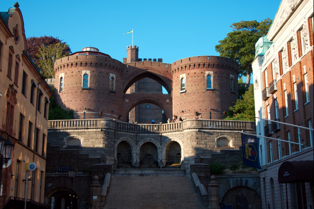
In the evening sun the fields and some infrequent menhirs
light up in red and gold. 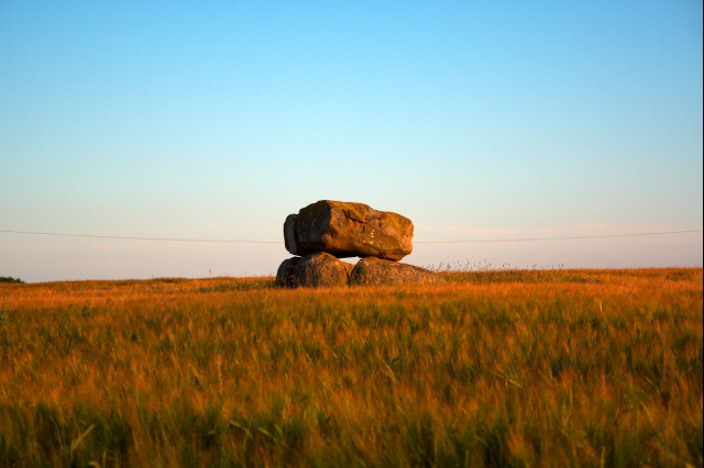
Sadly, i did not find a suitable place for my tent as the darkness comes. The region is far to populated, and does not feature forests or secret places. For this reason, i set up my tent at the camping site of Landskrona. It is just as expected: Near my tent a couple of noisy drunkards have a party and vomit behind their tent. I am lucky that these guys fall asleep about 1am.
170km, 9:30h, 1000m difference in altitude, 170m max. height, sunny weather, steady head wind.
I start the day with a walk in Landskrona. I like the citadel
and the coastal promenade.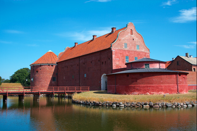
The next highlight is Malmö. The huge, 8km wide bridge
over the Öresund is amazing! To sad that bicycling over the
bridge is forbidden. 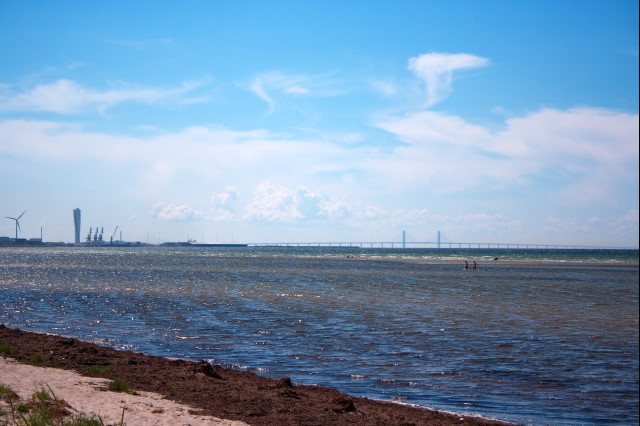
After that, i see many fields and farms on my way to the ferry
port in Trelleborg. 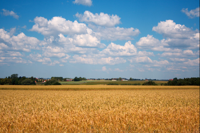
I arrive in the harbor shortly before 6pm. It is difficult to find the ticket office in order to pay the fee for the ferry to Sassnitz - there are nearly no instruction signs for bicyclists, everything seems to be designed for cars only. My ferry starts at 10pm, thus i have plenty of time. In front of the ticket office i chat with a bicyclist from Finland, who wants to take the ferry to Sassnitz as well. Together we drive to a nearby beach in order to swim and eat a little.
I am very lucky that i have so much time left until the departure of the ferry: My gearshift cable breaks in the shifter-box on the handlebar. I am even more lucky that my new Finnish friend has a screwdriver of the right size in his pocket. Although we worry that we lose some tiny parts, within one hour we manage to open the shifter, remove the slivered remainder of the wire, and fiddle the replacement wire into the shifter.
The passage for bicyclists to the ferry is a small, locked gate in
the fence. 10 minutes before the ferry departs, someone comes,
unlocks the gate and let us drive into the ferry over the
ordinary ramp for the cars - i cannot see any reason for this
complicated procedure. All other ferries i used in the last days
let cyclists simply go on board together with the cars. 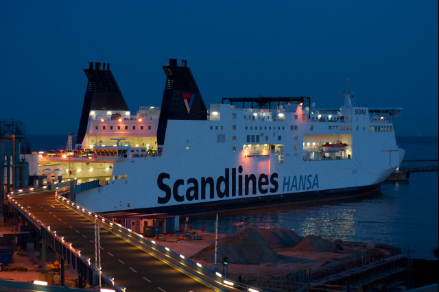
102km, 5:45h, 400m difference in altitude, 64m max. height, cloudy weather, light head wind.
The crossing from Trelleborg to Sassnitz lasts about 4 hours, i.e., we arrive in Sassnitz in Germany at 2am in the darkness. First we manage to find a good place in a small conifer forest to set up our tents and get some sleep. Actually, my friend from Finland has very few baggage, as compared to me. He even uses a short, thin sleeping mat that lets his leg lie on the ground, and he has remarkably few spare clothes. However, i reassure myself that he does not intend to sleep in snow-covered mountains...
After getting up we have a sightseeing trip to the fisher's
harbor in Sassnitz. There, we enjoy a bread roll with kipper
("Schillerlocken": smoked eel). After that, we take the cycle
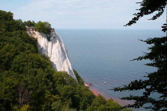
path through the Jasmund national park. There are many tourists at the
Königstuhl, a cliff made of chalk. However, the white cliff
gleams beautiful in the sunlight, and it is worth the trip.
We stray around until 3pm. Then, to my regret, i realize that i still have to drive some distance today, in order to make my way to Magdeburg (i have relatives there which wait for me) within my last three days of vacation. Therefore, we have to say goodbye, and i head for the bank that connects the Isle Rügen with the inland. The small roads in Rügen are the worst i have ever seen in my life. They are made of dirt and round stones, and they are covered with sand. Until now, i could have used a trekkingbike. But now i am glad to have a mountain bike with suspension fork and broad tires.
I have dinner in Stralsund, and i continue cycling until i
arrive at a small lake where i swim a little and set up my tent
when it starts raining. 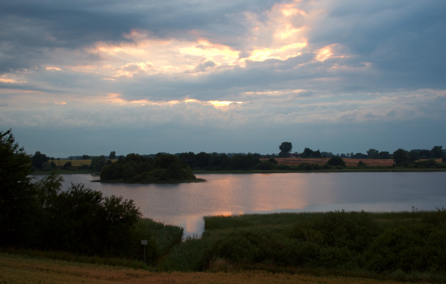
100km, 6:00h, 800m difference in altitude, 166m max. height, cloudy weather, rain in the evening.
Today i have no planned route on my GPS, not even a coarse one. Thus, i arrange that the GPS device shows the direction and distance to Magdeburg, and i simply take each road that goes in the right direction. After fighting against the head wind on crumbled, bumpy roads for some time, i find a nice country road with little traffic that takes me from Dargun over Malchin to Waren. In Malchin and Waren i appreciate coffee and cake in a bakery. Bakeries seem to be rare in the countryside of Norway and Sweden. There, gas stations fill the gap, but they have not that kind of fresh, delicious cake.
Since i drove through 3 thunderstorms, my rain clothes are wet
of rain from the outside and wet of sweat from the inside. In
Waren, to the astonishment of the pedestrians on the promenade, i threw all wet, dirty clothes in the Lake Müritz,
and wash out the mud and the sweat. After that i see that the public beach in Waren is for free, and i swim a little to clean myself. 
The Müritz is large as a small sea, but the water is
surprisingly warm. The weather must have been incredibly hot in
the recent days here. 
Since i still have plenty of distance to Magdeburg left, i
cycle for 30km until the night arrives. Then i set up my tent in
a conifer forest near Wittstock/Dosse.
152km, 8:00h, 1350m difference in altitude, 150m max. height, cloudy, three heavy thunderstorms, really heavy head wind.
Today is my last day on the road. I follow the nice country
road - which is still very little populated - over Wittstock and
Kyritz to Havelberg, and i look for a bakery in order to have
coffee and cake. The strong head wind is very annoying. I am in
Havelberg for the first time, and i am surprised how small the
city actually is. According to the fact that it has a cathedral,
and according to the road signs i expected a large city with some
over-regional importance.  Since my relatives encourage me to come as
quick as possible, i have to resign from the idea to cycle all
the way to Magdeburg. Instead, i take the ferry over the River
Elbe nearby Sandau, and i drive in heavy traffic over ugly
country roads through industrial areas to Stendal. There, i take
a local train for the remaining 50km. This is the end of my
bicycle trip. Tomorrow, i will have to take the train to be in
time at my workplace.
Since my relatives encourage me to come as
quick as possible, i have to resign from the idea to cycle all
the way to Magdeburg. Instead, i take the ferry over the River
Elbe nearby Sandau, and i drive in heavy traffic over ugly
country roads through industrial areas to Stendal. There, i take
a local train for the remaining 50km. This is the end of my
bicycle trip. Tomorrow, i will have to take the train to be in
time at my workplace.
114km, 6:00h, 700m difference in altitude, 123m max. height, cloudy weather, heavy head wind.
In absolute numbers i cycled 2,384km in 19 days. I was on the saddle for 137.5 hours, and the differences in altitude sum to 21.5km. On average i had 126km in 7:15 hours per day, at an average speed of 17.3km/h. This is quite comparable to my weekend tours in the Black Forest without baggage. I suppose that the short time puts some pressure on me so that i felt the need to hurry. However, except for the three days after taking the Hill near Nesbyen too quickly, i never felt exhausted or overburden. Anyway, i will try to provide more spare time for my next tour, so that i will have the time to make some more sightseeing trips and similar things besides cycling.
It was troublesome to wrap my bicycle so that it was able to survive the air transport. It was even more troublesome to carry the packed bike to the airport. If i do not find very good reasons to fly, i will avoid that the next time. I do not like flying anyway, and i think i can reach most places in Europe by train and ferry, if i add some extra hours.
I am not sure if i would like to have another bicycle trip in Norway ever. In the north, the weather was too bad. There were many boring parts of the road between the interesting spots, which are o.k. in good weather, but which are no fun to cycle in the rain at all. In South Norway, the landscape is too similar to the Black Forest which i see every time when i look out of my front door. The large masses of gnats and midgets add its share.
On my trip i found Sweden surprisingly attractive. First, the weather was sunny all the time. Second, the west coast of Sweden is beautiful, and the landscape with all that skerries is different from anything i have seen so far. Numerous cities, many prehistoric sites and many impressive buildings ensure that one never gets bored. It never happened that i cycled for 30km without anything in the landscape changed or without passing an interesting object to visit.
I was puzzled to realize that i never felt as if i would be in a foreign country. Perhaps, one reason was that i always could talk with the locals: Almost all people spoke fluent English. This is quite different from a trip, say, to Italy or France where i do not understand anyone.